In mid-March Andrea and I loaded up our little truck camper and headed south. We drove towards Utah as quickly as we could, along freeways for much of the way. It still took us three days of driving to get to our planned destination – the canyon areas around Moab. But, along the way some interesting and scenic stops …….
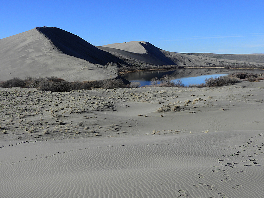
The Bruneau Dunes State Park in Idaho was a lovely place to stop over, and do a little hiking among the extensive sand dunes.
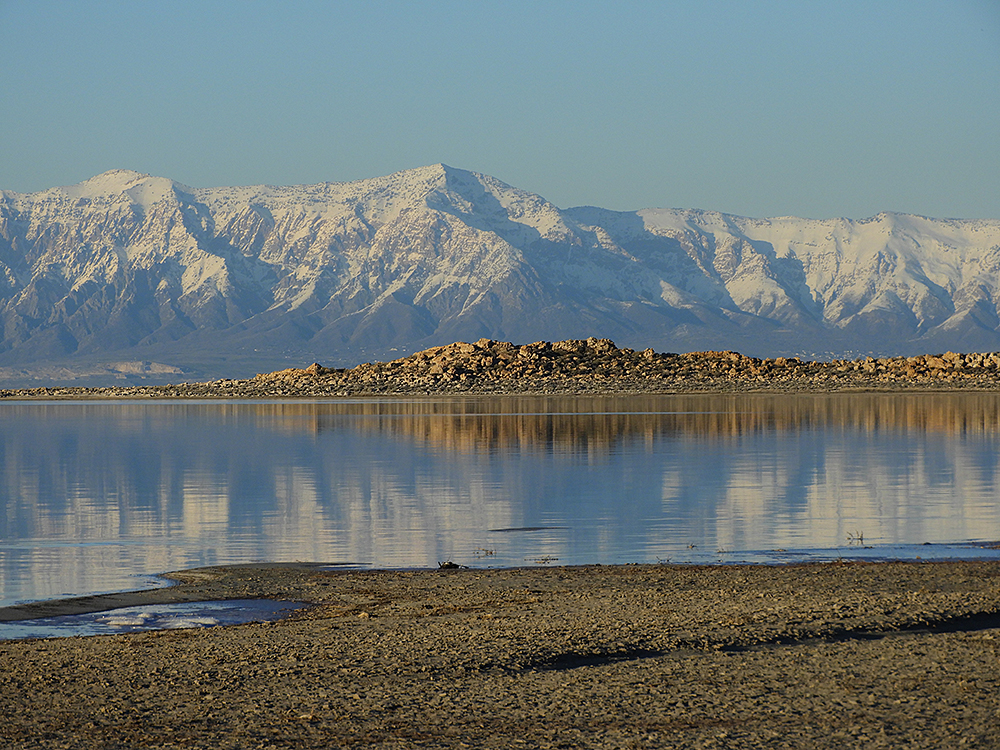
Great Salt Lake from our campsite on Antelope Island, with the mountains behind Salt Lake City in the background (and yes, the water does taste very salty).
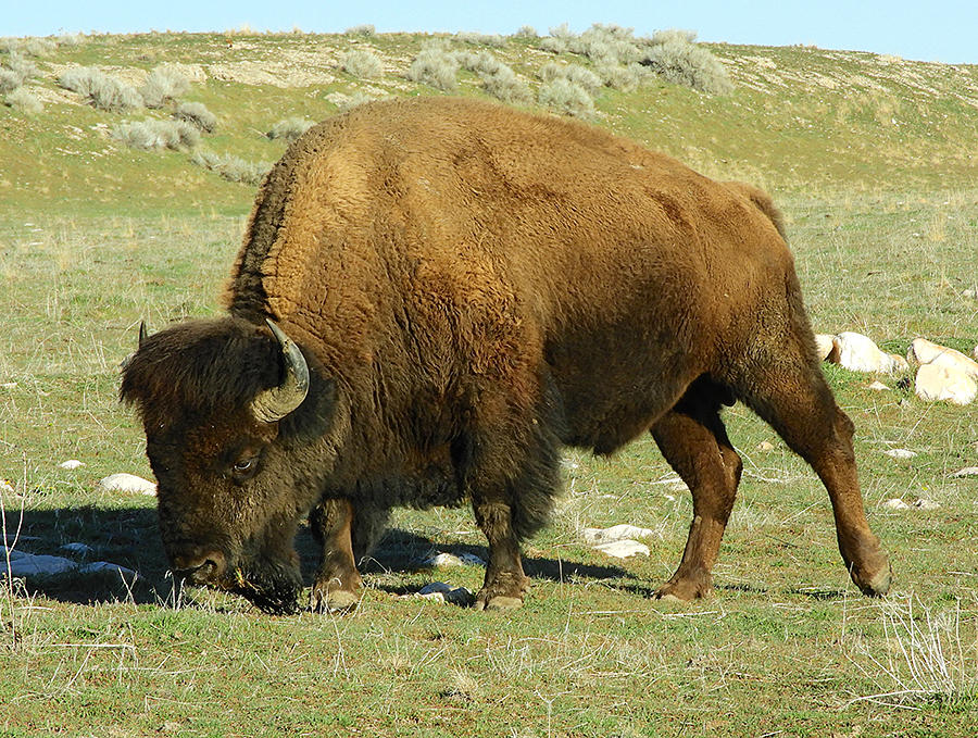
We didn’t expect to find a herd of Bison on Antelope Island, within sight of Salt Lake City.
Finally in the canyon country in Utah. Our first few days were at Horsethief Camp, just north of Canyonlands National Park. This is a favourite location for mountain bikers but the trails they had made were also excellent for hiking.
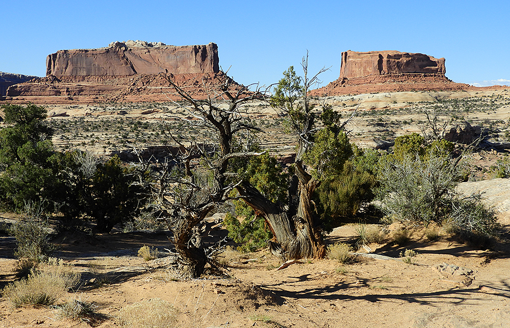
Big mesas of Navajo sandstone on the road to Horsethief Camp, Utah.
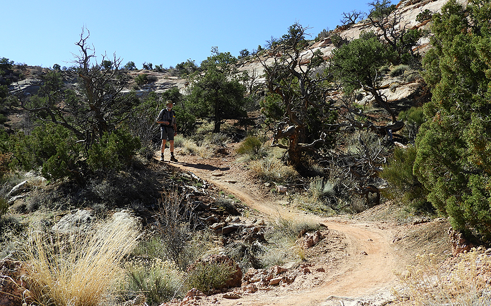
Hiking the mountain bike trails at the Horsethief Camp area
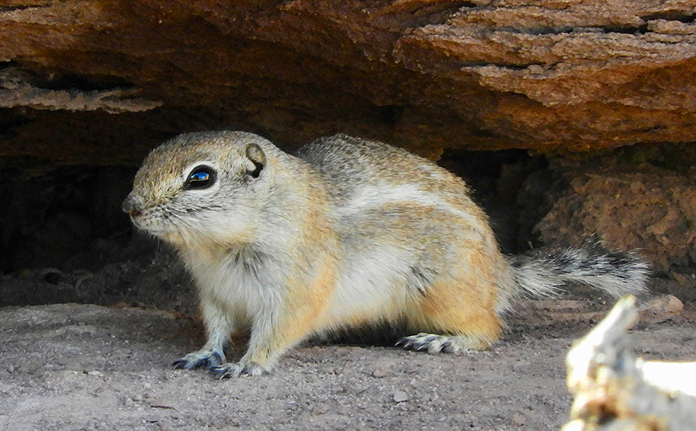
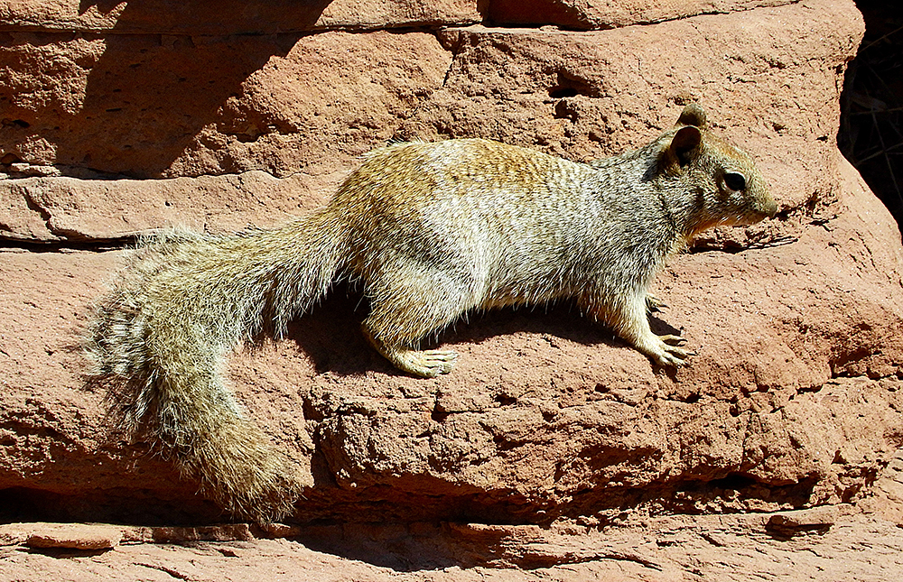
One of the little ground squirrels common throughout the canyon area of Utah – a White-tailed Antelope Squirrel
Our next stop was a couple of days in Dead Horse Point State Park. This park is on the high plateau overlooking the immense canyons carved out of layers of sandstone by the Colorado River. We were on top of a mountain without having to climb. We hiked scenic trails along the cliff edges.
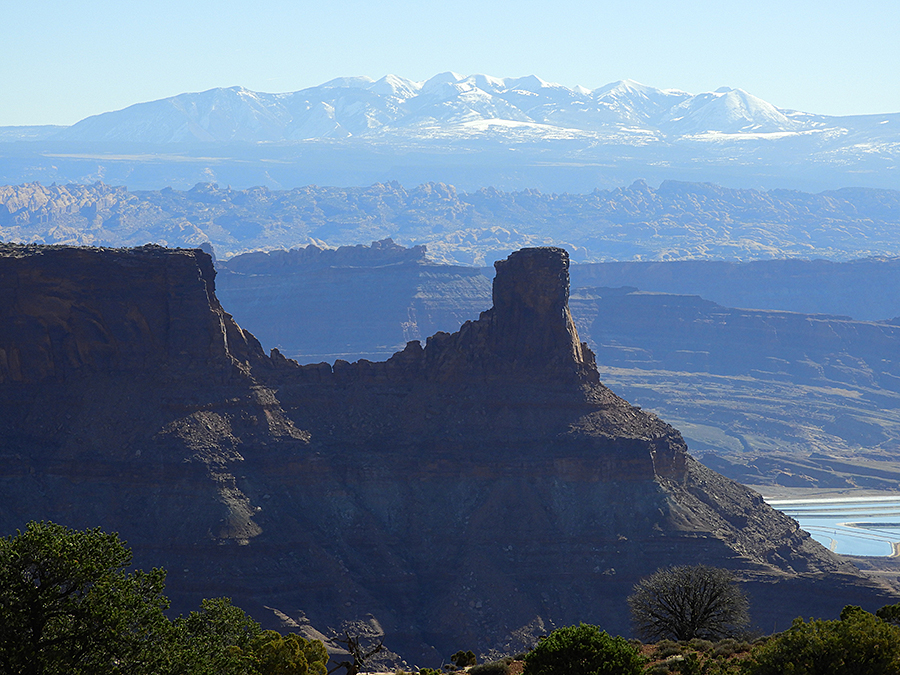
The view from Dead Horse Point State Park, looking towards the mountains behind Moab. The blue ponds in the bottom right are evaporation ponds for extracting potash.
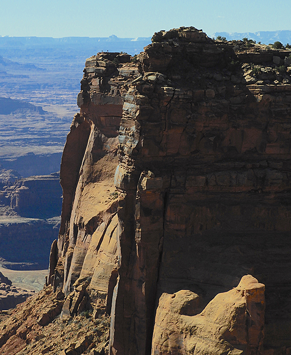
Dead Horse Point – look carefully to see the two people on the clifftop, providing scale to these immense cliffs.
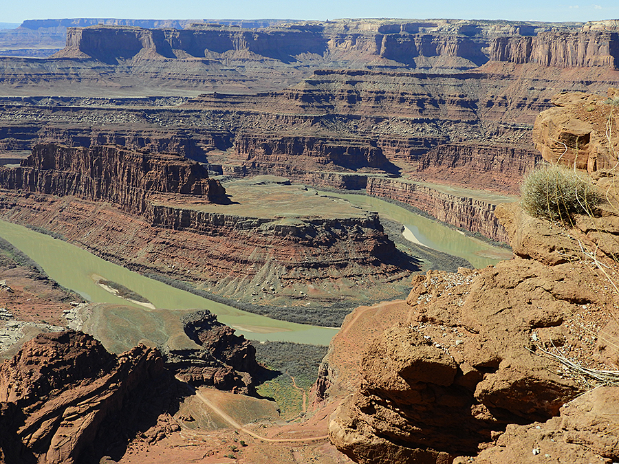
The Colorado River has carved these magnificent canyons, on its way to the Grand Canyon further south.
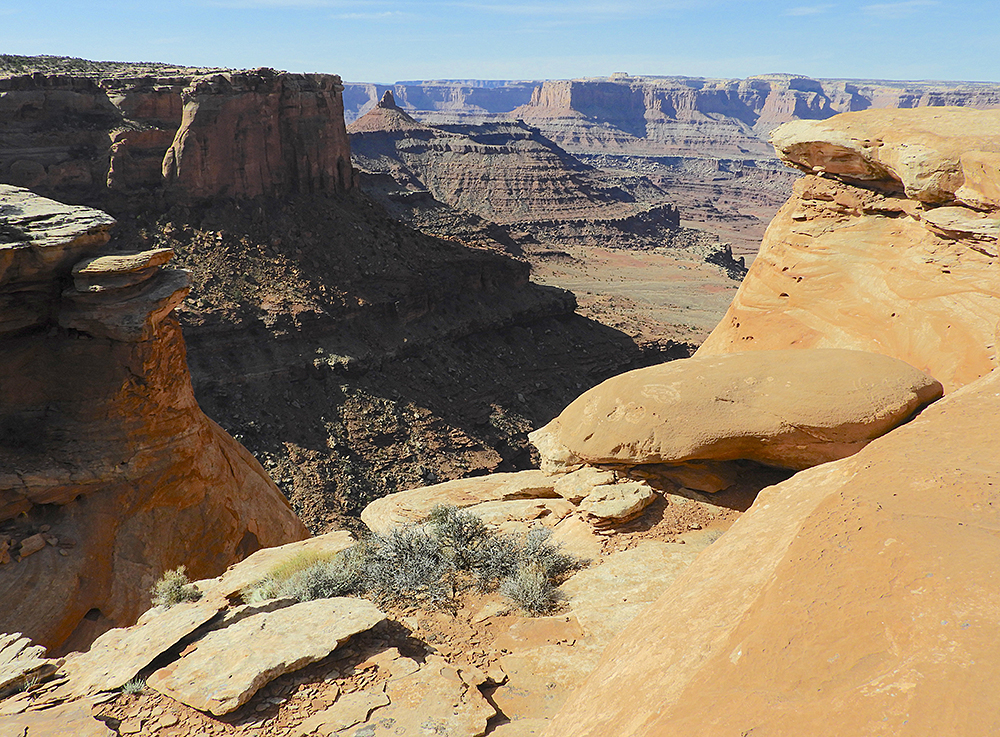
Views from one of the hiking trails at Dead Horse Point State Park, Utah. The Island in the Sky portion of Canyonlands National Park is on the plateau on the horizon.
True to their name, Rock Squirrels live right on the edges of the immense cliffs. We watched them chasing each other within inches of the abyss.
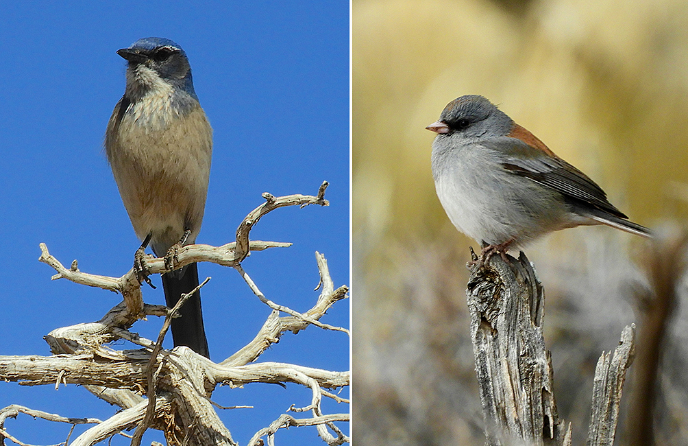
Two of the more exotic (for us) birds in the canyon lands – a Woodhouse’s Scrub Jay (left) and a Grey-headed Junco (right). The junco is a variant of the very common Dark-eyed Junco which we have in our backyard in British Columbia.
Next we moved a few km over to the Islands in the Sky part of Canyonlands National Park. One cannot book the campsites here so we scooted over early in the morning and managed to snag a very nice site where we stayed for three nights.
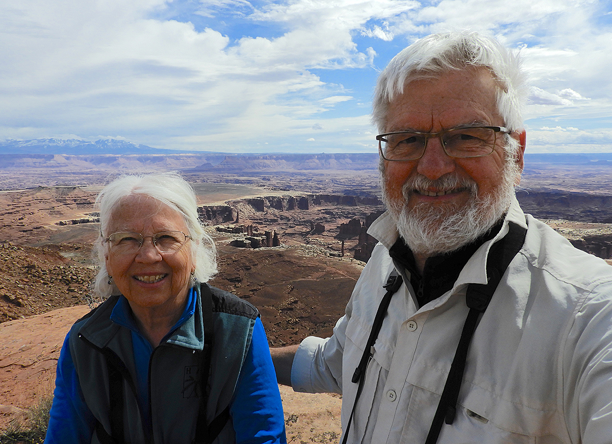
Andrea and Alan do the selfie thing at Canyonlands National Park.
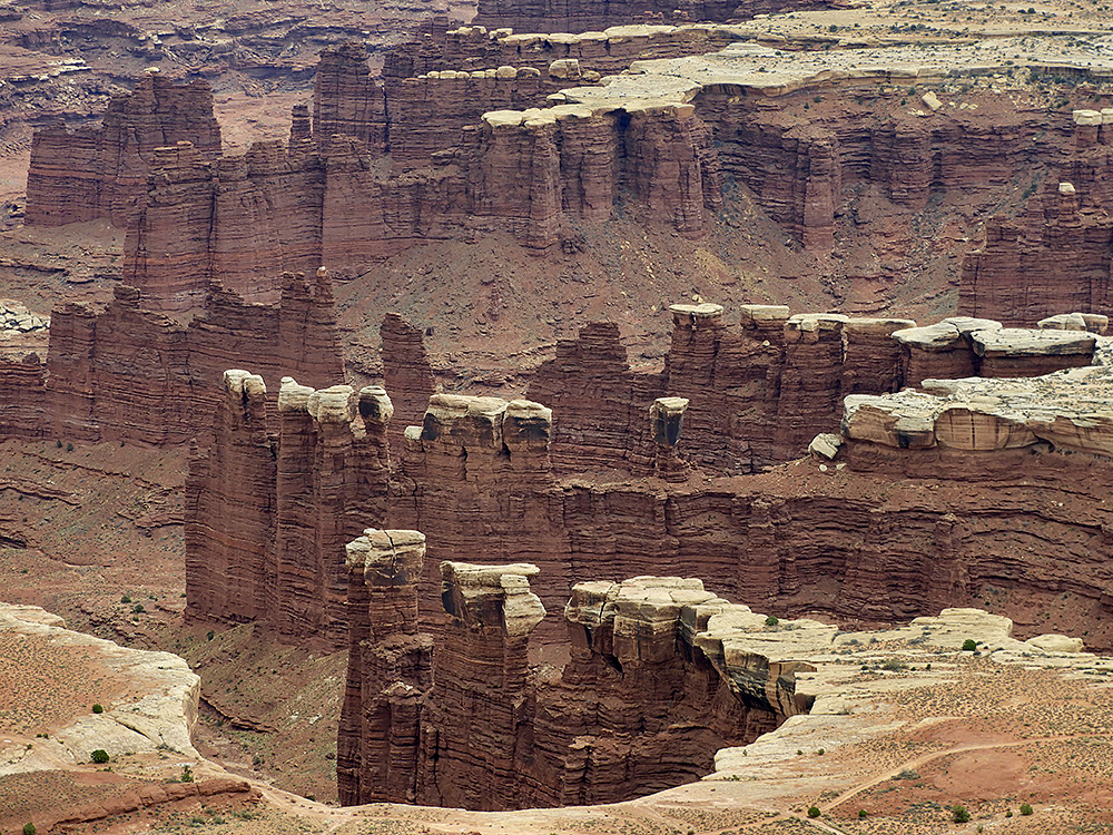
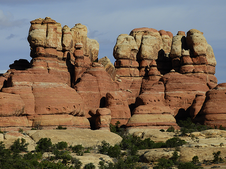
Wonderful rock formations and canyons far below our vantage point on the upper plateau. The harder white sandstone forms resistant caps on top of the softer reddish sandstone.
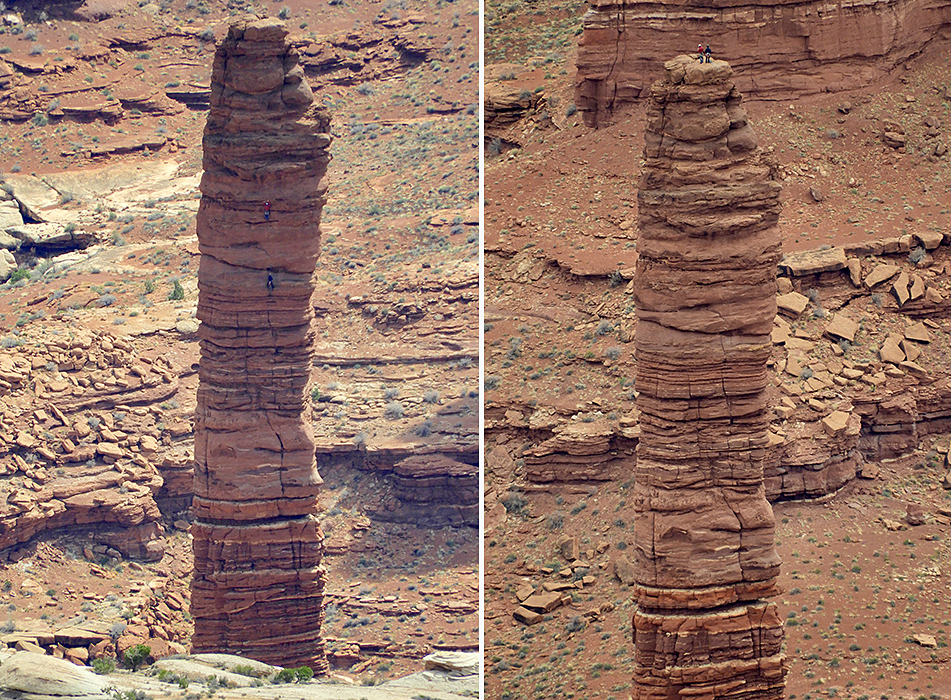
We were amazed to see two climbers ascending the Totem spire – 305 feet (93 metres) high.
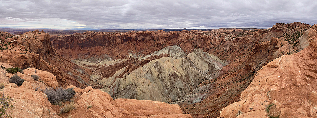
This huge intrusion, known as the Upheaval Dome, was probably formed by the collision of a large meteorite. The feature is 3 km wide.
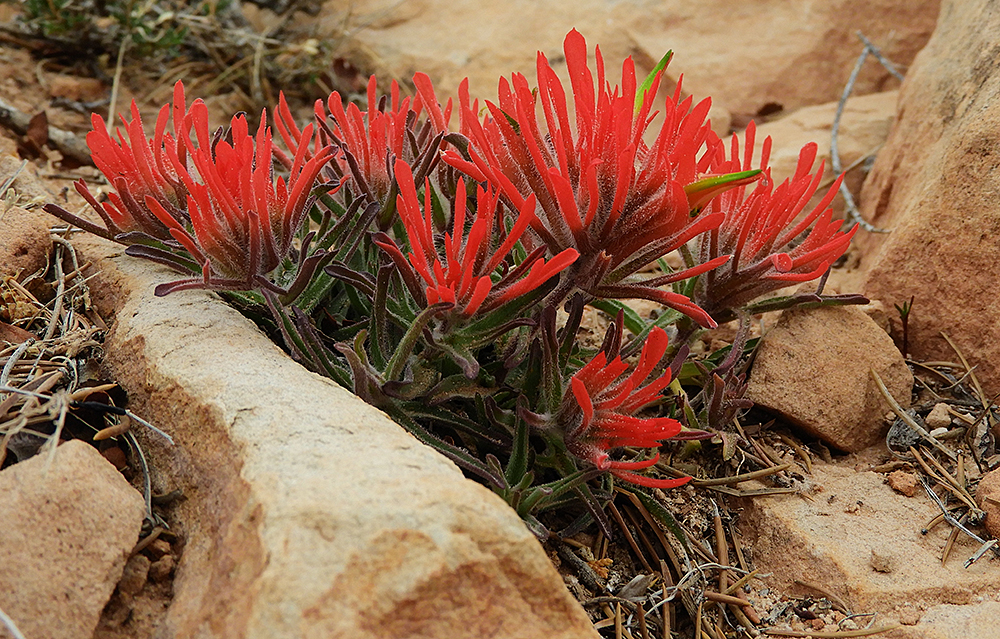
A splash of colour in the rocky landscape – Zion Indian Paintbrush (Castilleja scabrida)
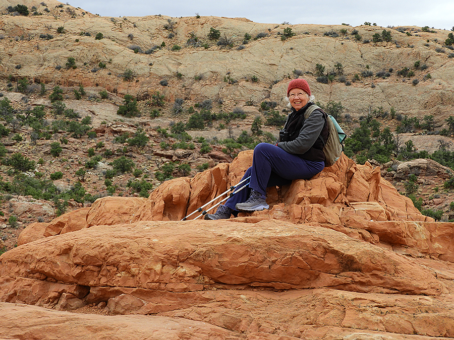
Andrea on a Canyonlands hike.
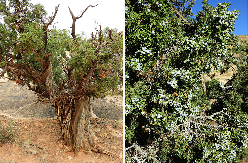
Utah Juniper (Juniperus osteosperma). Many of these trees are hundreds of years old, gnarled and twisted. A somewhat younger tree on the right is loaded with juniper berries which are actually fleshy cones.
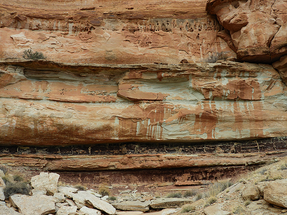
Art in nature – on a gigantic scale. The blackish band near the bottom is 2 metres thick.
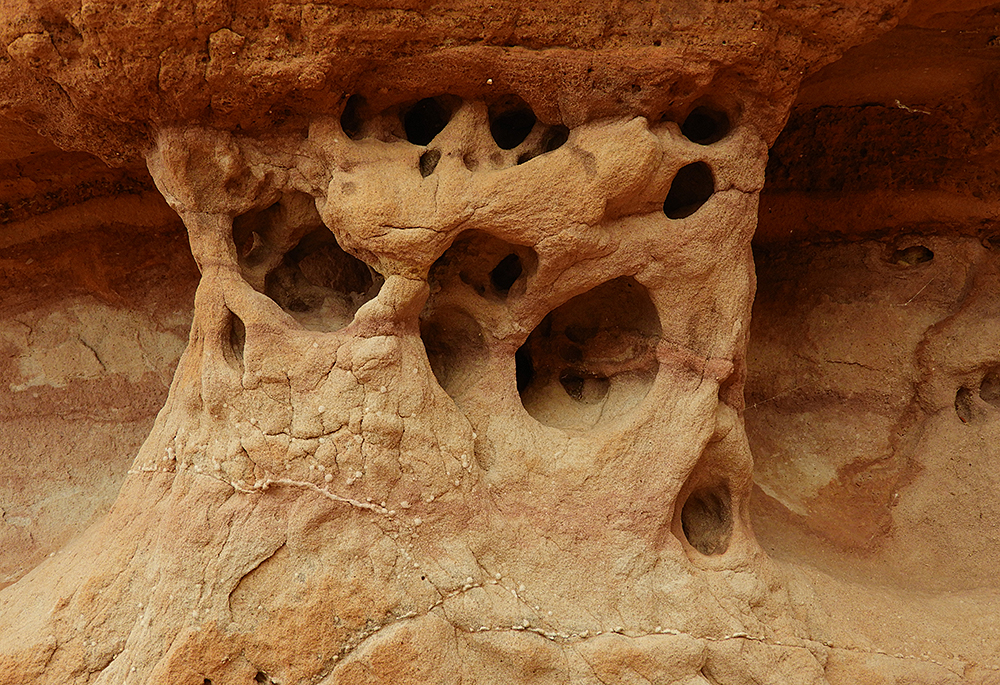
Art in nature – sandstone sculpted by rain and wind.
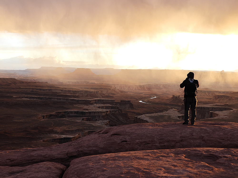
A dramatic sunset with rain clouds at Island in the Sky, Canyonlands National Park. The river in the distance is the Green River which joins with the Colorado River in Canyonlands National Park.
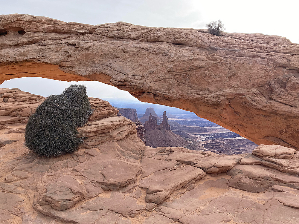
Mesa Arch at Canyonlands National Park.
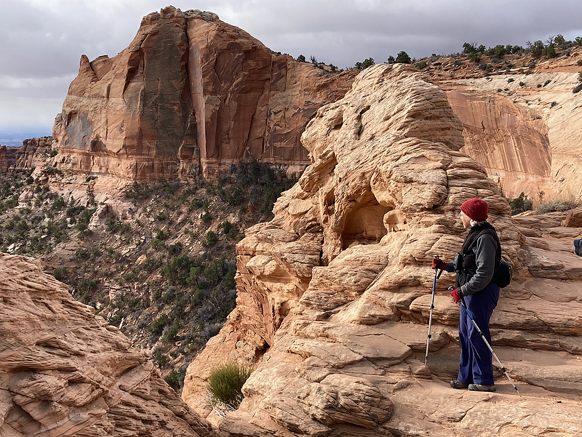
Cliffside scenery – Mesa Arch area.
On 25th March we left the Island in the Sky portion of Canyonlands National Park, re-stocked with food in Moab and continued south towards the Needles portion of the same park, separated by over 100 km of road travel.
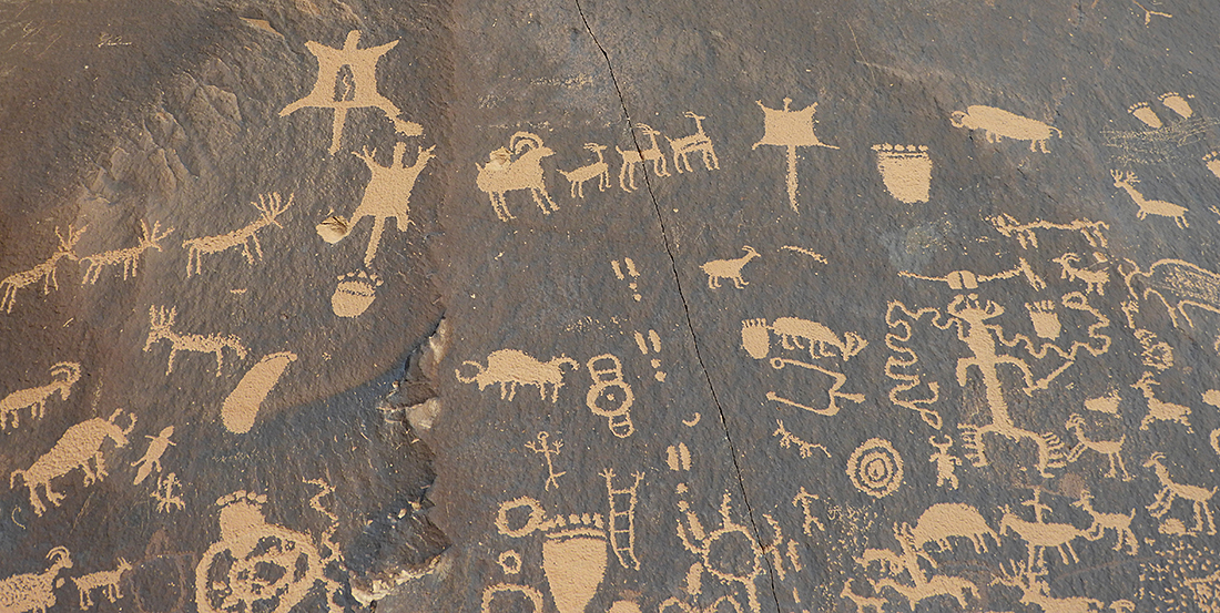
Petroglyphs on the road between Moab and the Needles portion of Canyonlands National Park.
We spent one night at the BLM (Bureau of Land Management) campsite near the Needles to be close to the Needles campsite.
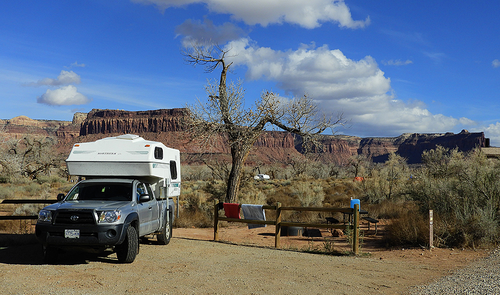
Our camp at Creek Pasture BLM campsite. Most of the campers at this site were rock climbers, taking on the cliffs that you see in the background.
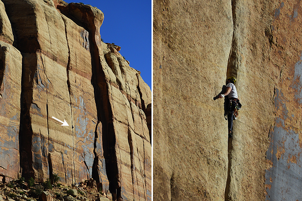
We stopped to watch the rock climbers at the Indian River cliffs. The tiny figure in the left photo is shown again, zoomed in, on the right. We were very impressed!
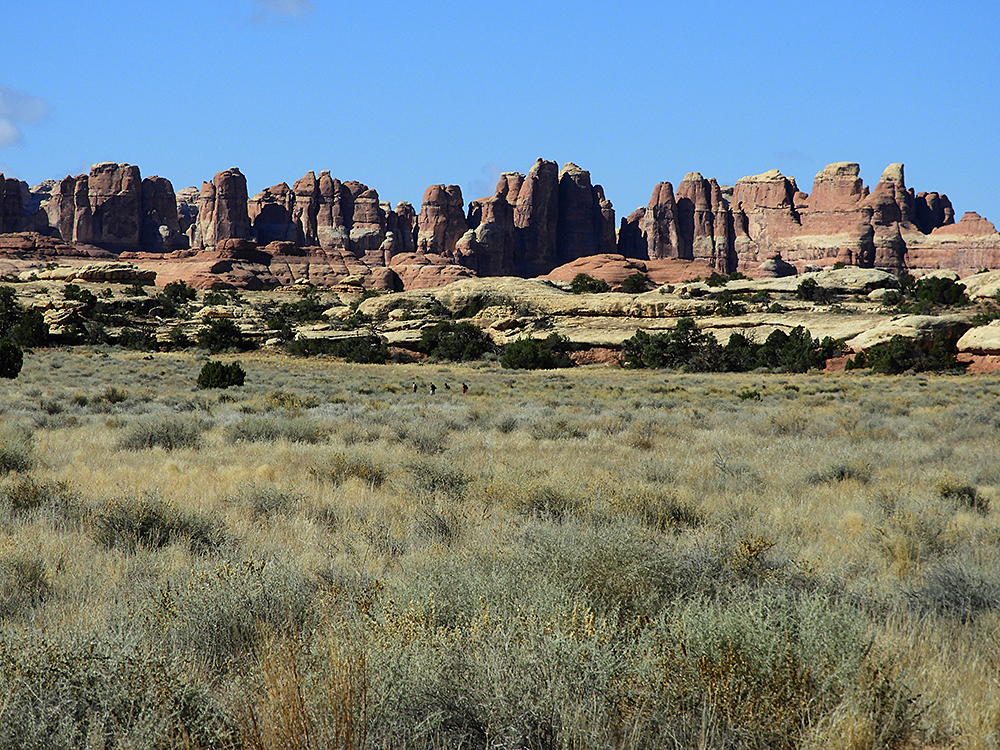
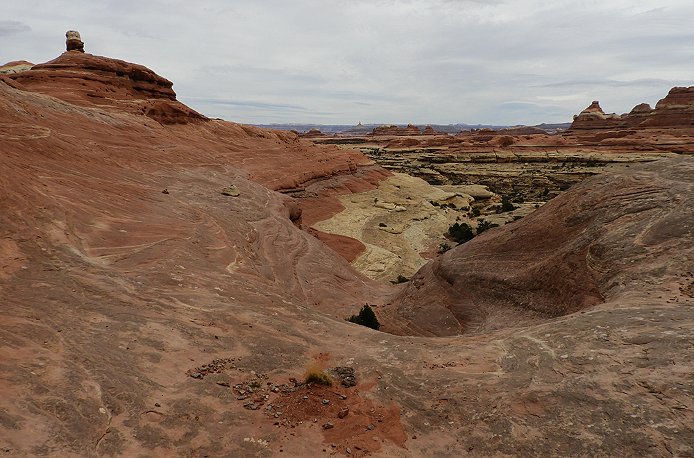
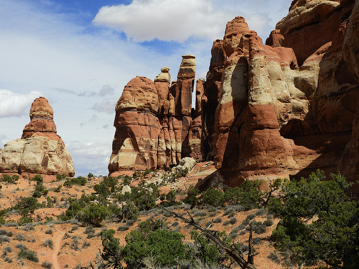
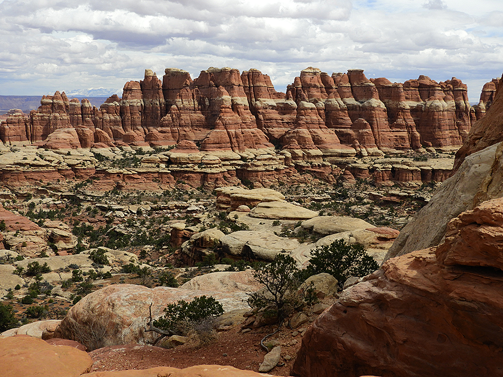
Needles! A sample of the wonderful scenery that we enjoyed for our week at Needles in Canyonlands National Park.
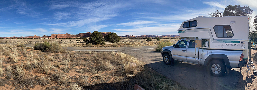
Our camp at the Needles portion of Canyonlands National Park.
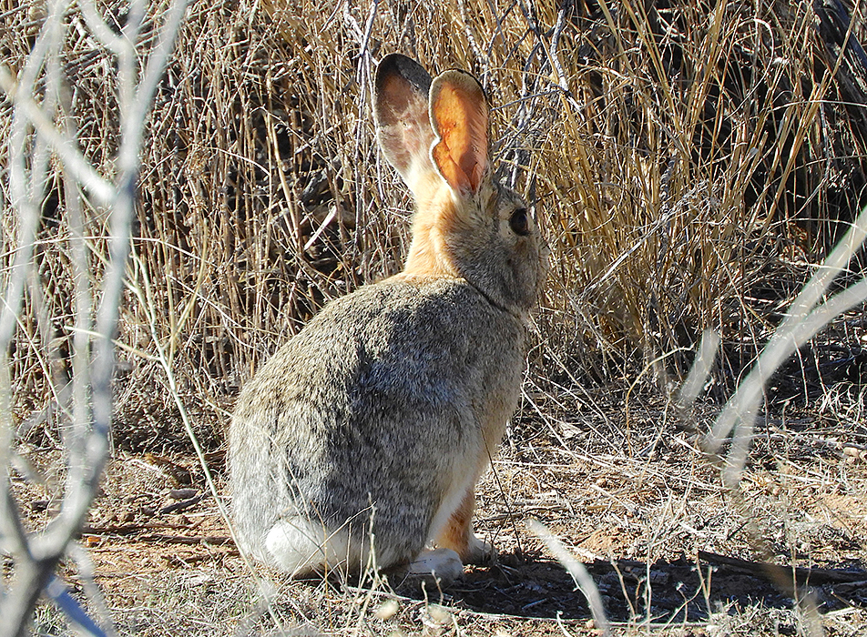
We shared our Needles campsite with this Desert Cottontail. That was appropriate because it was Easter weekend, but bunny evidently didn’t get the Easter egg message.
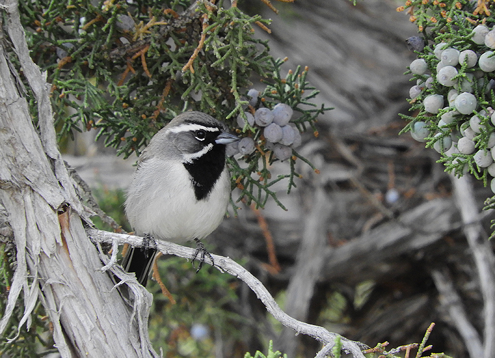
Another resident at our campsite was this beautiful Black-throated Sparrow, sitting in a juniper bush. Who knew that a sparrow could be so striking.
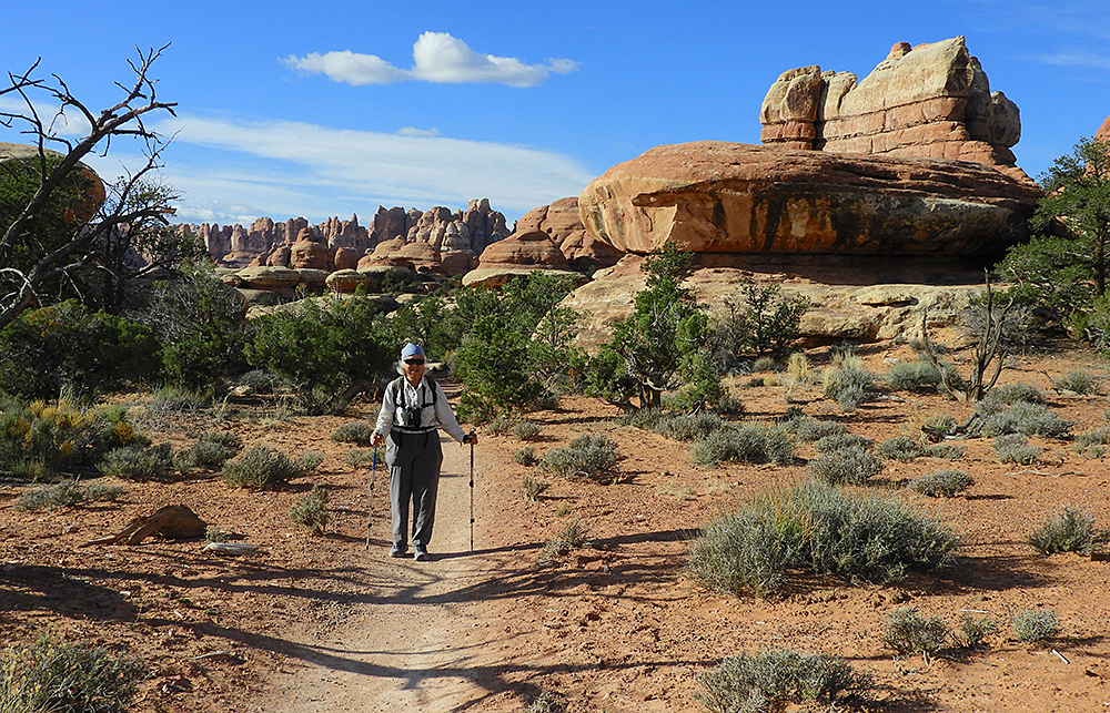
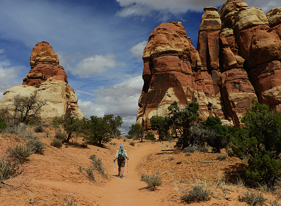
Andrea on one of the many trails in the Needles park.
The hiking trails often traversed large areas of slickrock – mostly easy hiking but sometimes steep and exposed.
Eroded sandstone formations.
One has to ponder at the time it takes to erode sandstone in a desert environment to create these lovely formations.
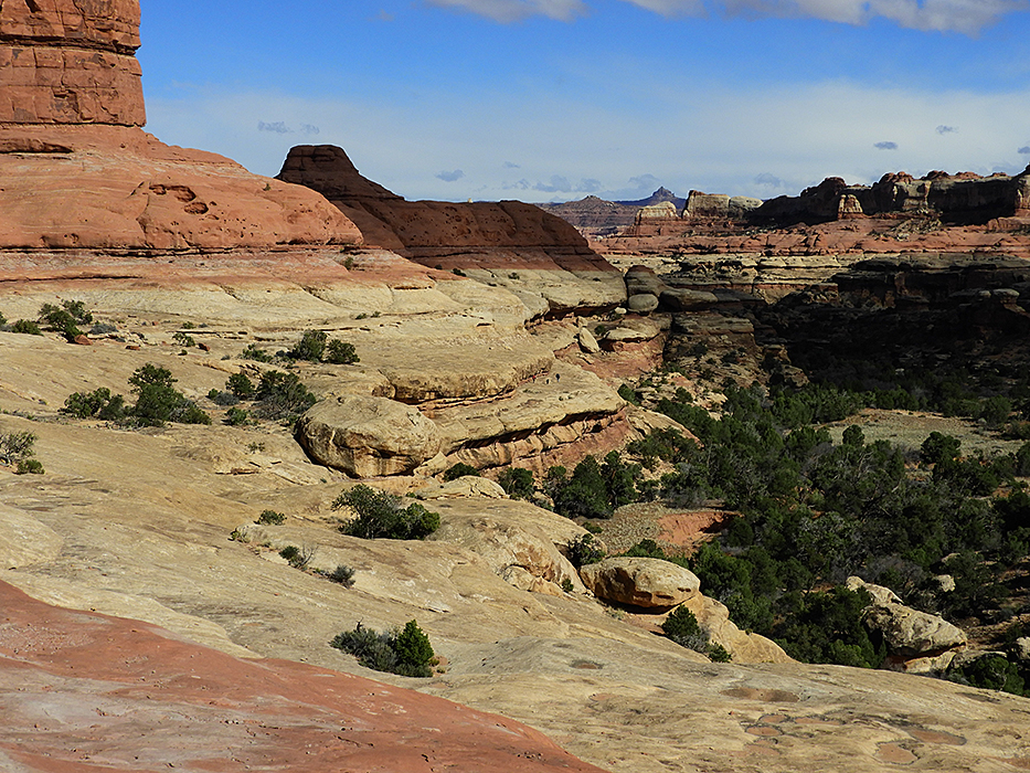
At every turn in the trails there was more exquisite scenery. In the far left distance are the snowy mountains near Moab.
An easy portion of the 12 km hike from our camp to the Chesler Park needles and back.
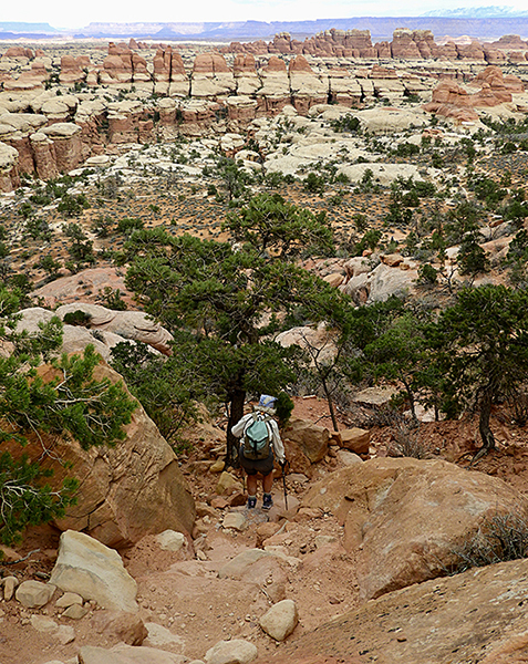
But there were also steep and tricky portions along most of the trails.
Along the Peekaboo Trail – notice the people traversing the rock ledge mid-picture.
We had a splendid week in the Needles park, and then headed for home. Instead of busy freeways, we chose to go along back roads – first heading west across Utah into Nevada and then north up Nevada, Idaho, Washington and eventually British Columbia.
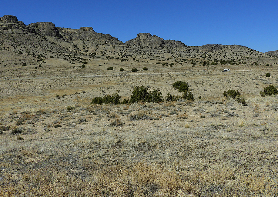
Semi-desert country on the border between Utah and Nevada – we traveled through many miles like this.
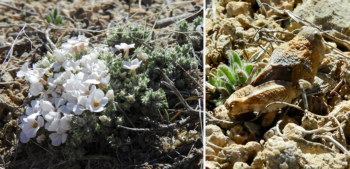
But if you get out and look around there are many little treasures, like this Squarestem Phlox (Phlox muscoides) or the well camouflaged Saussure’s Blue-winged Grasshopper
(Leprus intermedius).
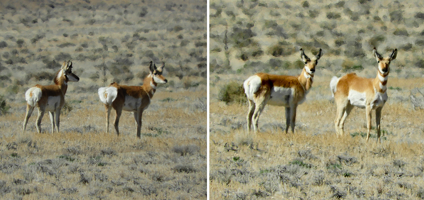
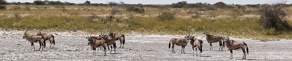
We also encountered a few small herds of Pronghorn Antelope – apparently one of the few animals that thrive eating sagebrush.
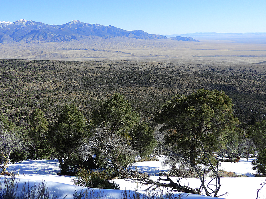
We spent a night at the Great Basin National Park in Nevada, right on the Utah border. The mountains here rise out of the flat desert plain to impressive heights. We camped in fresh snow in the high elevation campground.
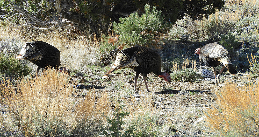
Wild Turkeys in Great Basin National Park.
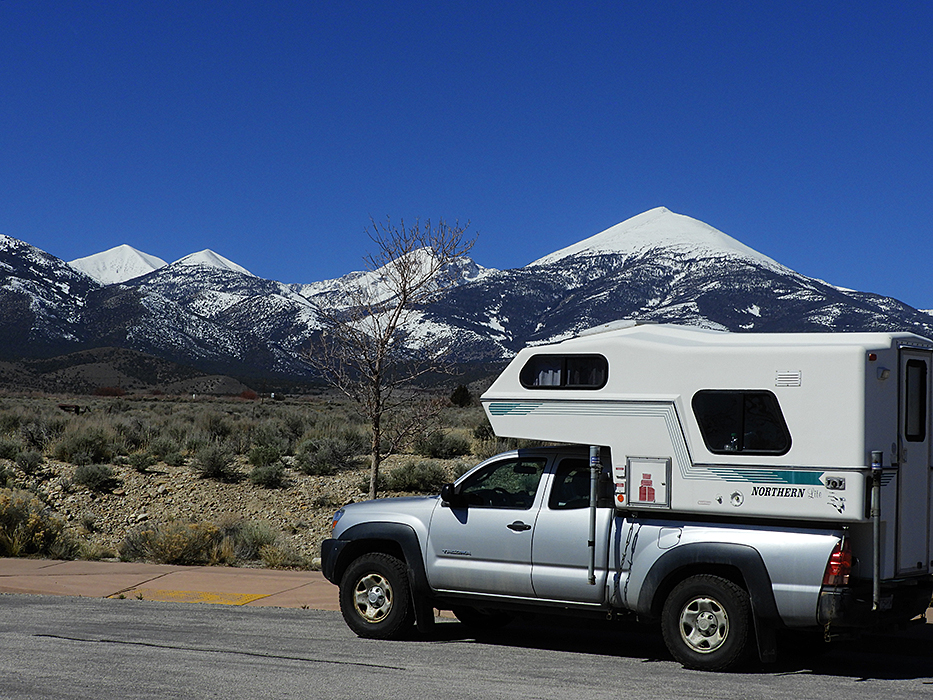
The mountains in Great Basin National Park, Nevada. The highest is Mt Wheeler at 13,063 feet (3,980 m) and several of the others are over 10,000 ft (3,000 m).
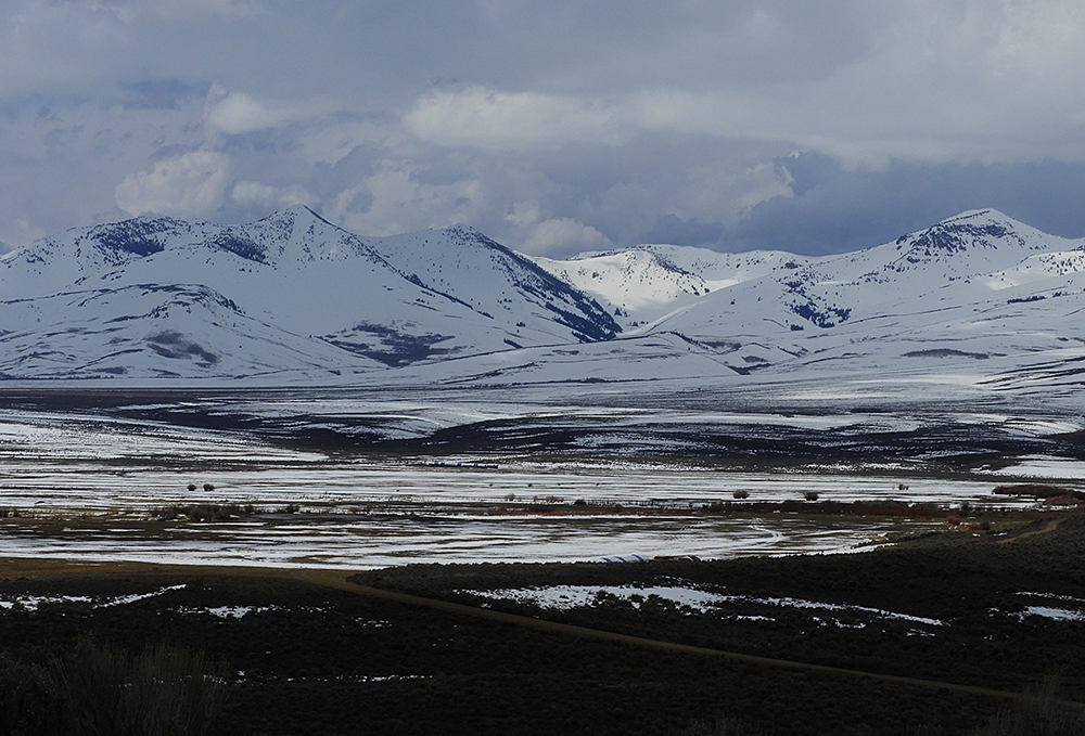
We had days of unexpected cold weather in Utah and Idaho. This scene was in Nevada near the Idaho border.
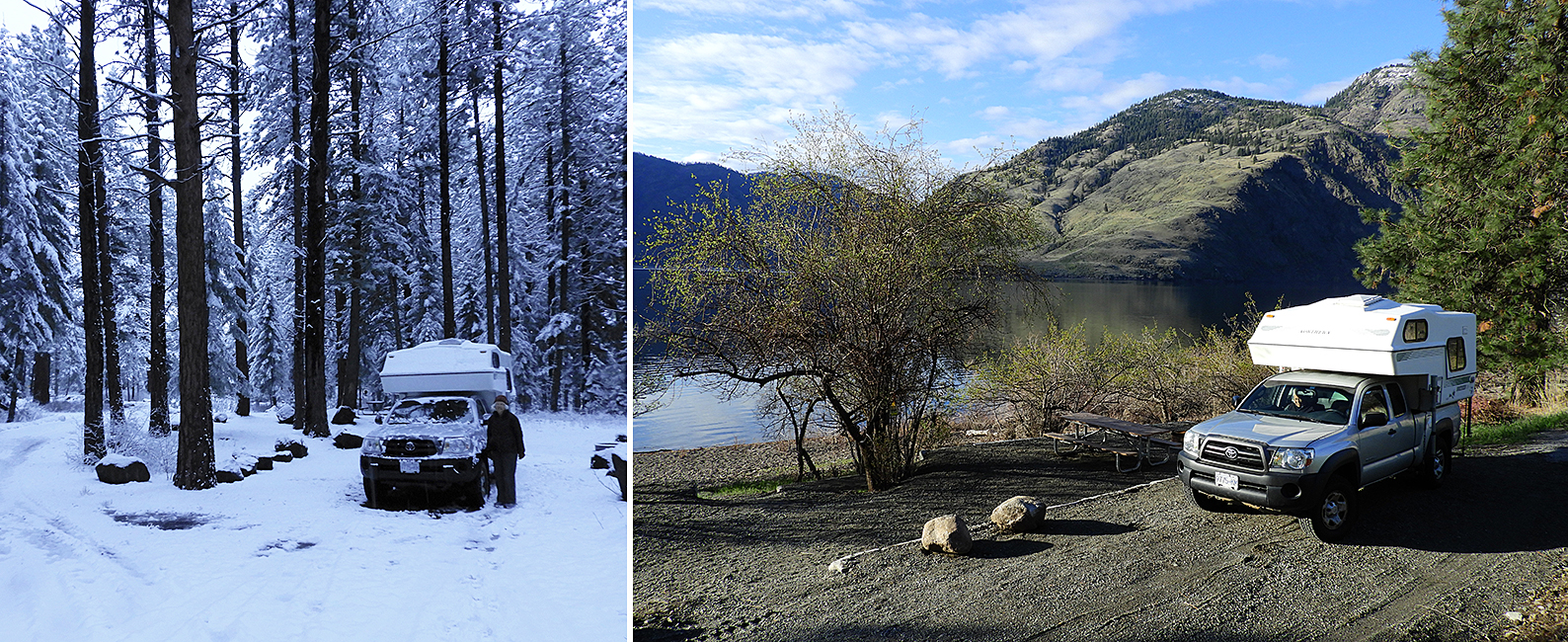
Contrasting campsites on the last two nights of this journey. We camped in deep snow and icy conditions at Winchester, Idaho. Got out of there before breakfast. Our last night was in relatively balmy and sunny Palmer Lake in Washington near the B.C. border at Osoyoos.
Over three weeks away we traveled close to 5,000 km, through five states and our home province. As usual, it wasn’t long enough!
~~~~~~~~~~~~~~~~~~~~~~~~~~~~~~~~~~~~~~~~~~~