In early July Chris Lepsoe and I did a 2-day overnight hike to Zupjok Peak, continuing to Alpaca Peak in the mountains near Coquihalla Pass. We left our vehicle at the parking lot of the Coquihalla brake-check. The first few km of the hike takes one through beautiful old-growth forest. After a few minutes the traffic noise from the Coquihalla highway fades away and one is left with an ongoing chorus of beautiful birdsong – Varied Thrush, Townsend’s Warbler, Pacific Wren and the haunting flute-like calls of numerous Hermit Thrush.
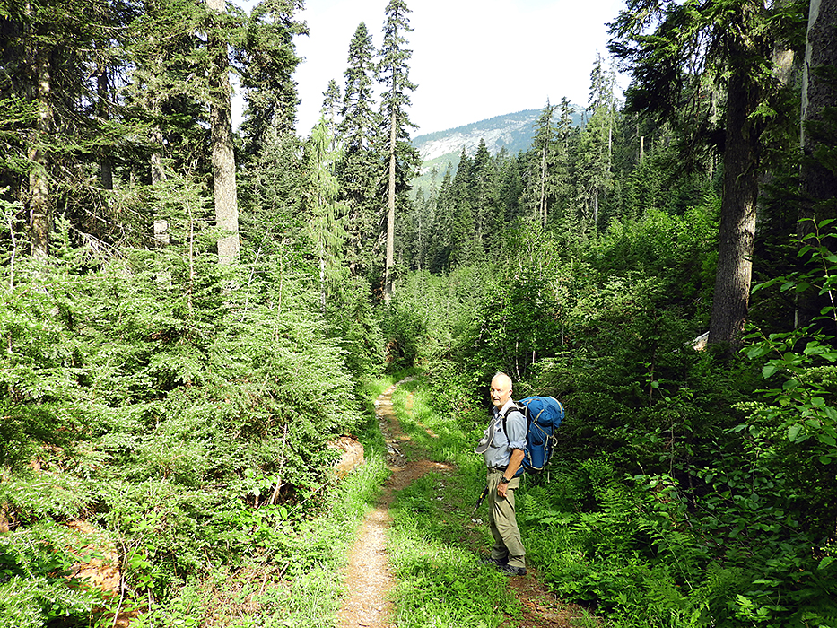
Chris near the start of our hike, in the lovely old-growth forest. The trail follows an abandoned road for several easy km. Zupjok Peak is visible on the horizon – a step on our route.
All too soon the trail turned north and headed up the steep ridge towards Zupjok Peak. This is a sweaty uphill slog for a couple of oldies like us. As we approached the treeline a huge thunderstorm broke loose. Not wanting to be on the exposed ridge with all the lightning strikes we huddled under the stunted subalpine trees as the rain poured down for almost an hour. Eventually the weather moved on and we climbed the final stretch to Zupjok Peak and the alpine ridge beyond.
On the Zupjok ridge looking toward the Anderson range to the northwest. Chris is still wearing his gloves after getting chilled during the thunderstorm.
An interesting bird sighting as we gained the ridge was a pair of Black Swifts riding the strong winds that accompany the thunderstorm.
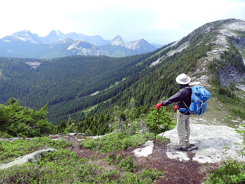
We hiked along the ridge for about a km but realized that there was no opportunity to camp along the ridge – no water and sparse shelter from any winds. So we clambered down on to the sloping meadow below the ridge looking for a level spot to camp.
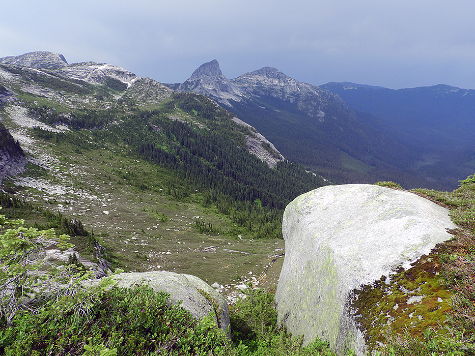
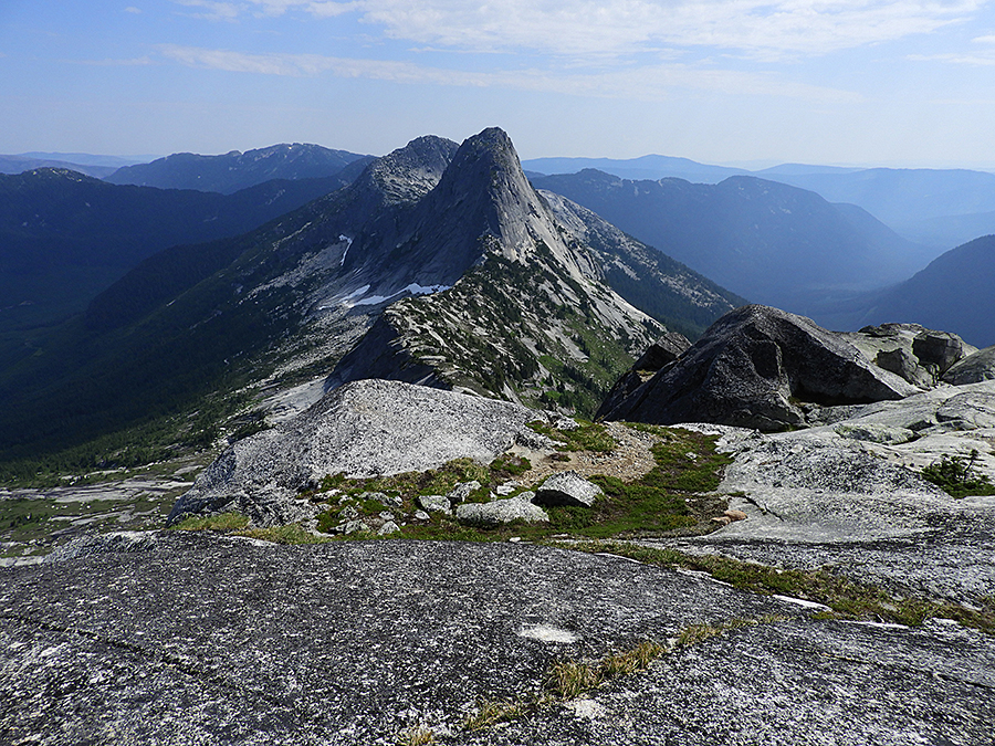
View along the Zukjok ridge with the shark-fin Vicuna Peak and rounded Guanaco Peak in the distance. We climbed down to the sloping meadow below to find a camp site.
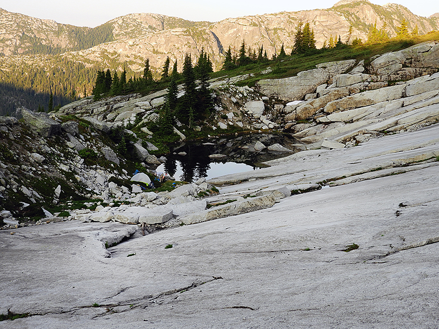
Eventually we found a lovely spot next to a pond between immense granite slabs and the rocky moraine that glacial activity created at the foot of the slabs.
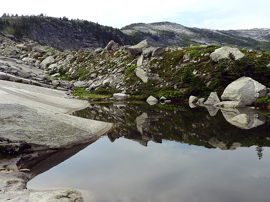
Our campsite next to a beautiful little pond between immense granite slabs and the terminal moraine created by ice sliding down the slabs. We camped next to the square boulder at the end of the pond.
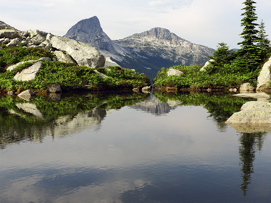
Vicuna and Guanaco peaks seen from our campsite pond.
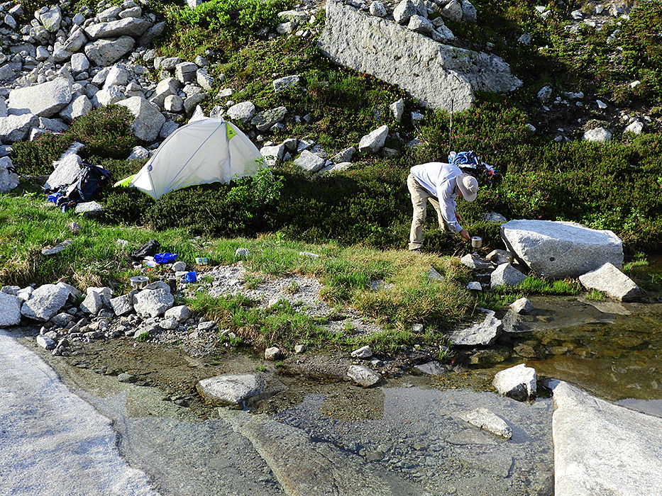
Our campsite near Zupjok Peak. Finding a level spot for my little tent and Chris’s bivvy bag was a challenge but we both ended up with comfy sleeping spots.
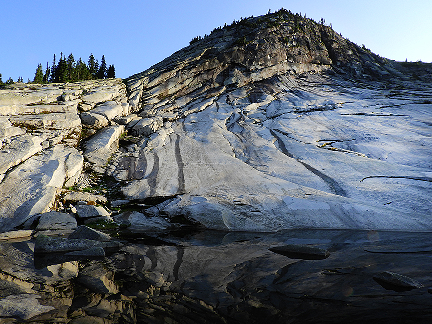
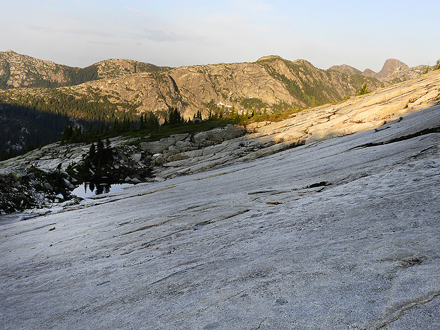
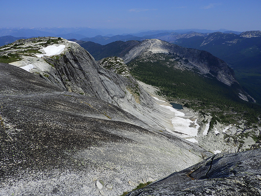
A late evening view of the granite slabs above our campsite.
Our campsite below the granite slabs.
Another view of our campsite giving a better impression of the size of the granite slabs.
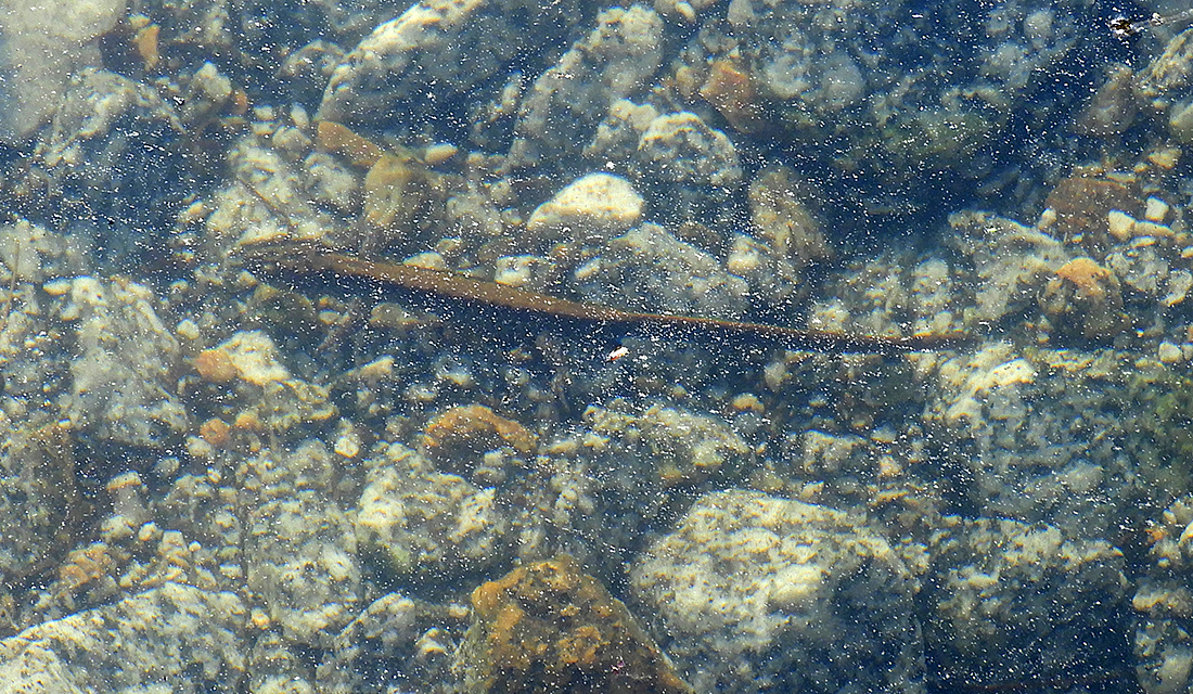
This Long-toed Salamander, about 12 cm long, was an unexpected resident of the campsite pond, along with many water beetles and caddis fly larvae.
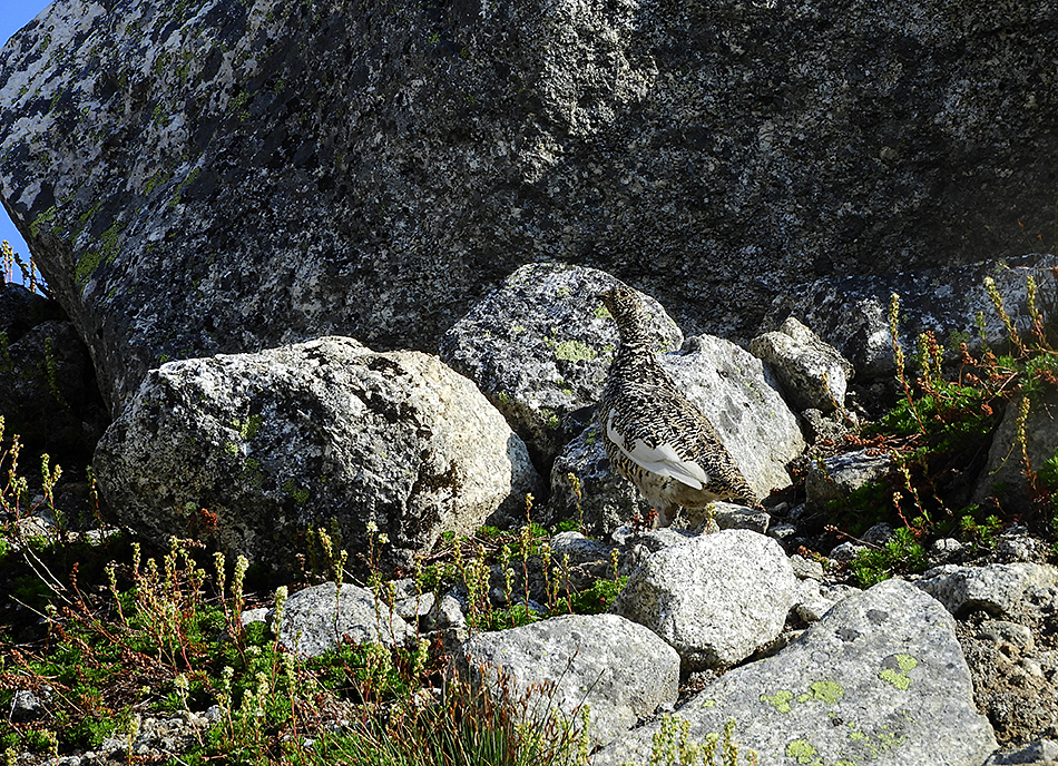
As darkness fell and we were already in our sleeping bags there was a loud chucking cry from nearby, repeated several times. The next morning as we were packing up to leave this mystery bird started calling again and this time we could find it close by – a male White-tailed Ptarmigan.
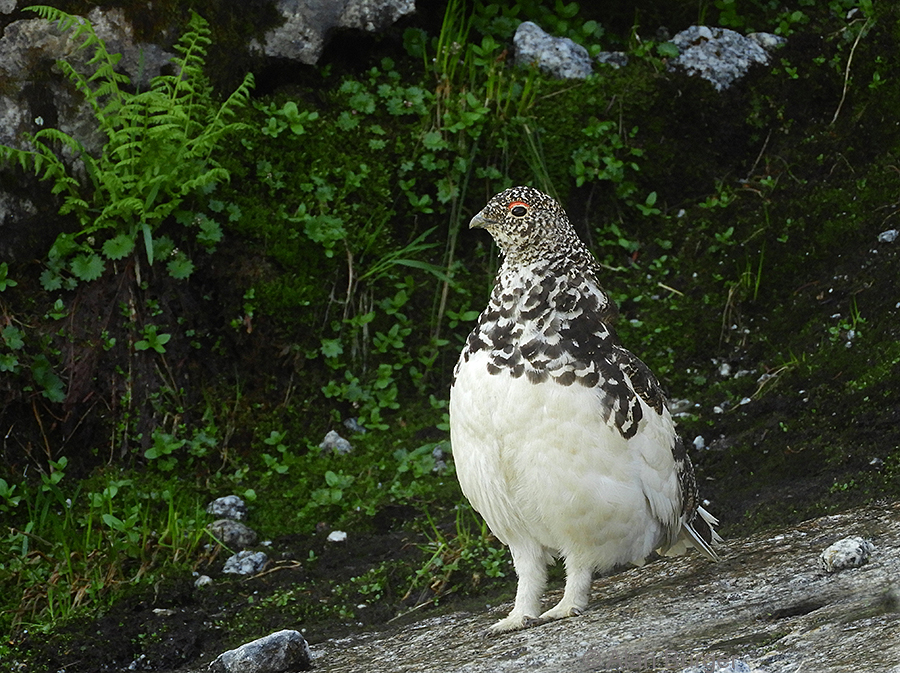
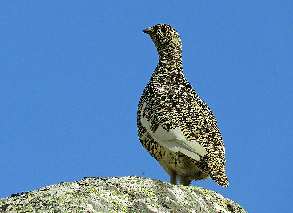
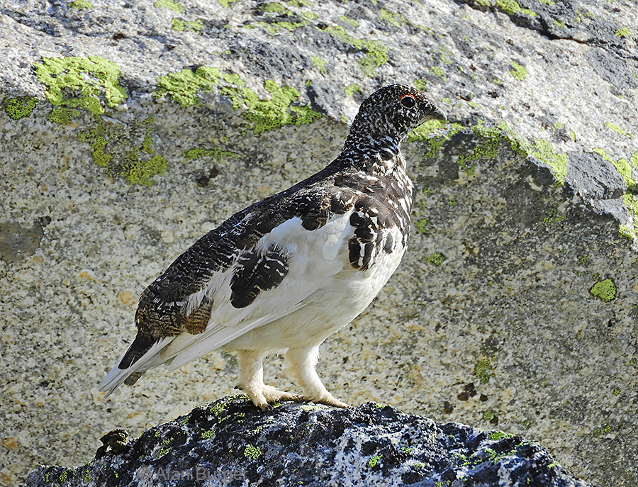
A male White-tailed Ptarmigan – the source of our mysterious evening calls. These alpine grouse are always a treat to find and one always has to do a lot of legwork to get into their usual alpine habitat. Notice the feathery legs – a feature of ptarmigan.
Meanwhile Chris had spotted a female ptarmigan with 5 small chicks close to our campsite.
The female White-tailed Ptarmigan – much better camouflaged than the male in this summer plumage. In winter they moult into pure white plumage but they retain their white wing feathers year-round.
The female White-tailed Ptarmigan on alert, with her five chicks running about nearby.
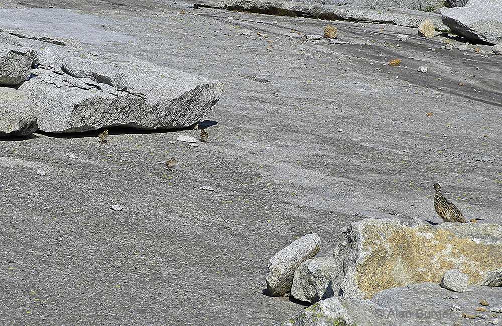
The female White-tailed Ptarmigan with four of her five tiny chicks running about on the granite slab – one chick is part-way under the rock.
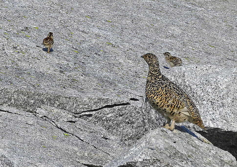
Female White-tailed Ptarmigan and chicks.
The male flew over to join the family but remained on the moraine, keeping watch.
After enjoying our time with the ptarmigan family we shouldered our packs and clambered back up to the ridge-top – a steep scramble in places. We left our packs hidden in a thicket and, carrying just water bottles, set off along the ridge towards Alpaca Peak.
A view back at our campsite at the foot of the open granite slabs.
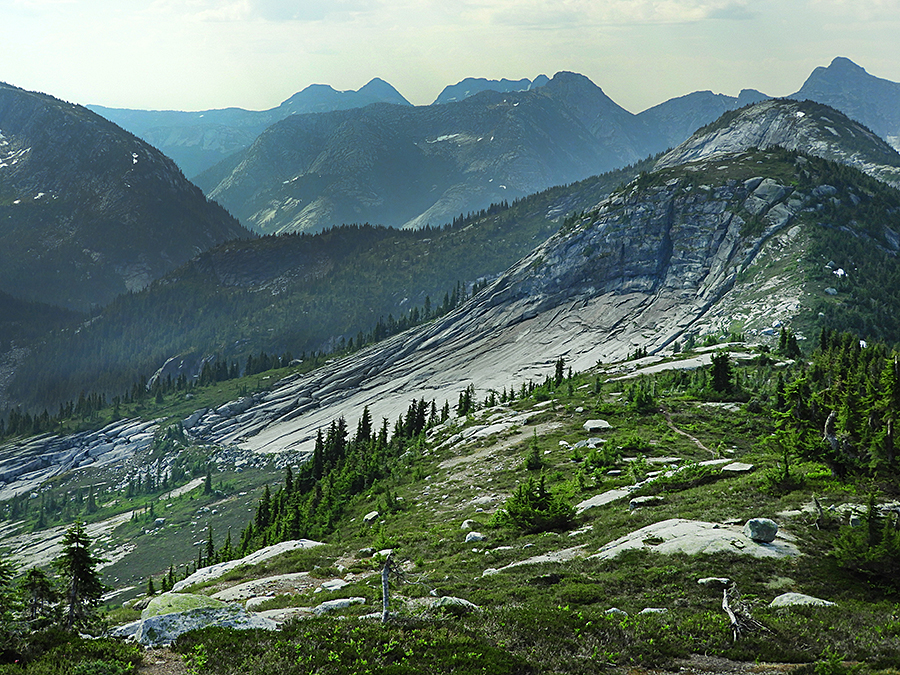
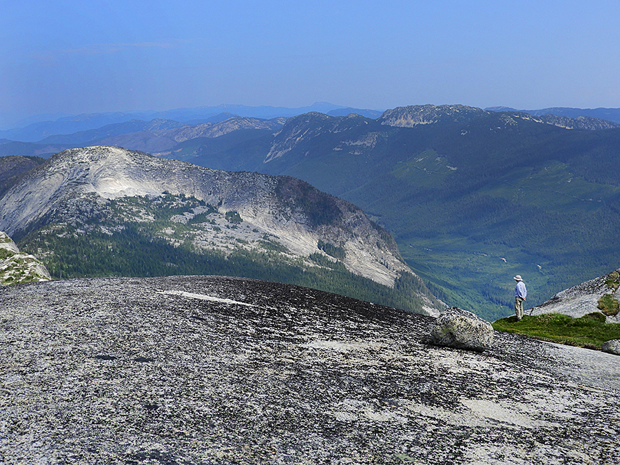
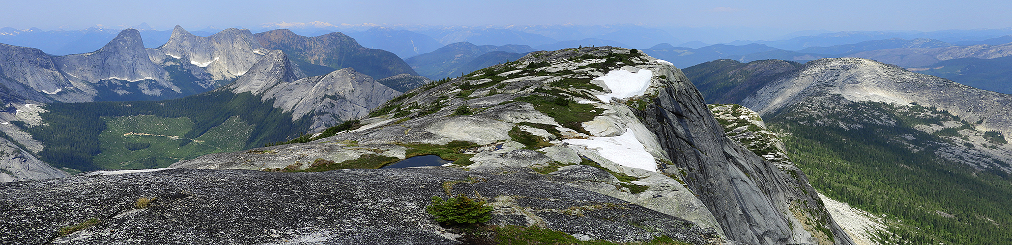
A panoramic view of the Zupjok-Alpaca ridge, looking south to southwest. The nearby rounded peak on the left is Zupjok Peak. Beyond that is the high Needle Peak and slightly to the right Flatiron Mountain – both of these have been hiking destinations for us in the past.
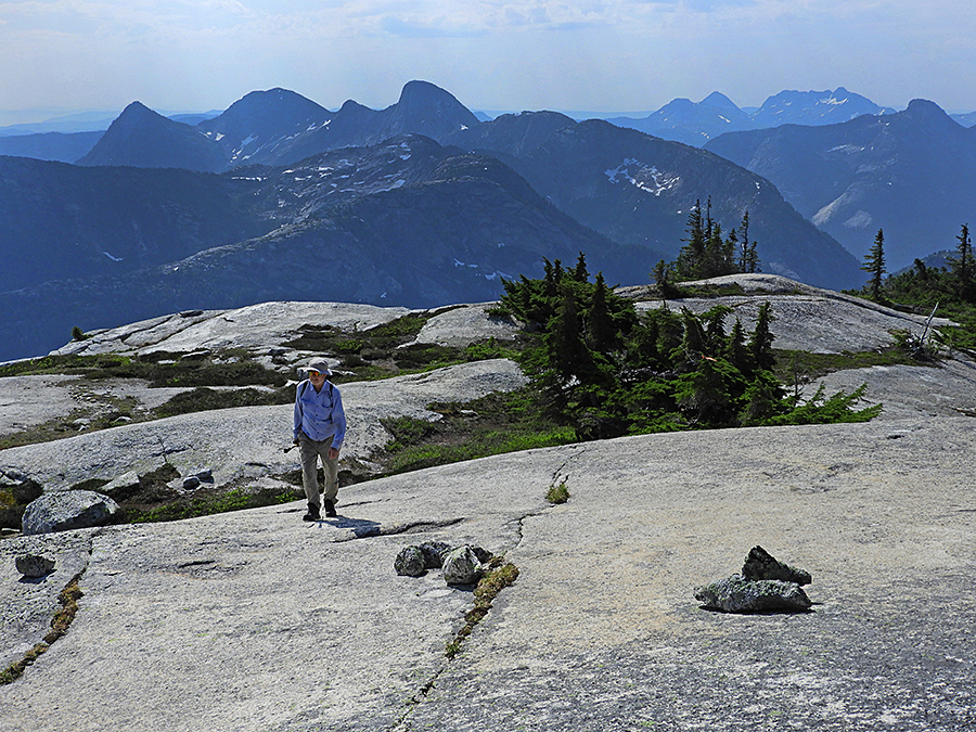
Alan on the ridge trail. Behind me is the route from Zupjok Peak along the undulating ridge. Looking along the horizon – to the far left is Zopkios Peak, then the distant Illal Creek ridge with the pyramid-shaped Jim Kelly Peak, jagged Coquihalla Mountain and then beyond Zupjok Peak is Needle Peak.
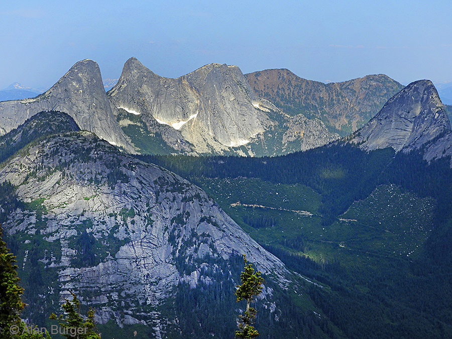
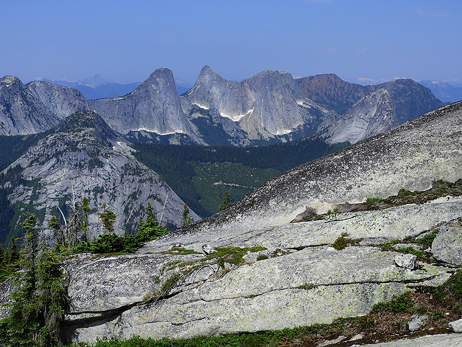
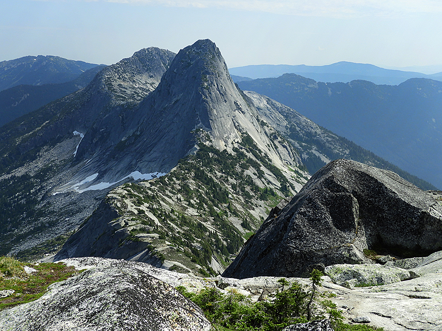
The impressive Anderson Range of peaks to the west of our route. In any other country this mini-Yosemite would be a national park, in B.C., sadly, it is just another logging site.
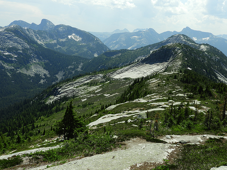
Much of the route along the Zupjok-Alpaca ridge is across granite outcrops – good and solid underfoot.
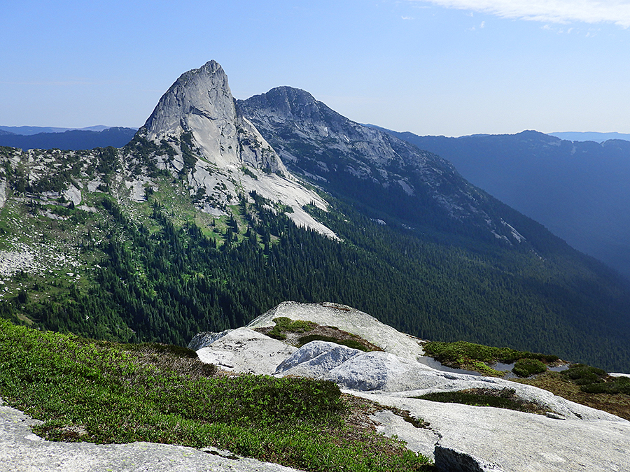
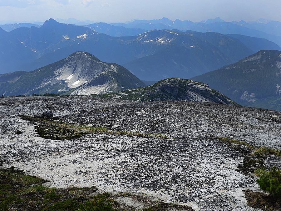
As we approach Alpaca Peak the view of Vicuna and Guanaco peaks to the east becomes more impressive.
Another view of the Anderson Range to the west of our route.
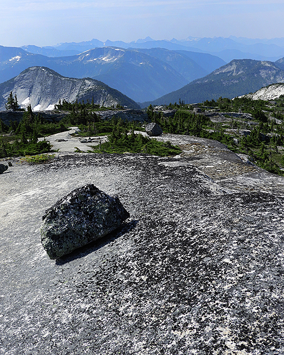
How did these huge boulders end up on the tops of granite ridges? We speculated that they were carried by the ice when the glaciers covered these mountains, dropped down through the ice and then were too massive to be moved as the glaciers dwindled.
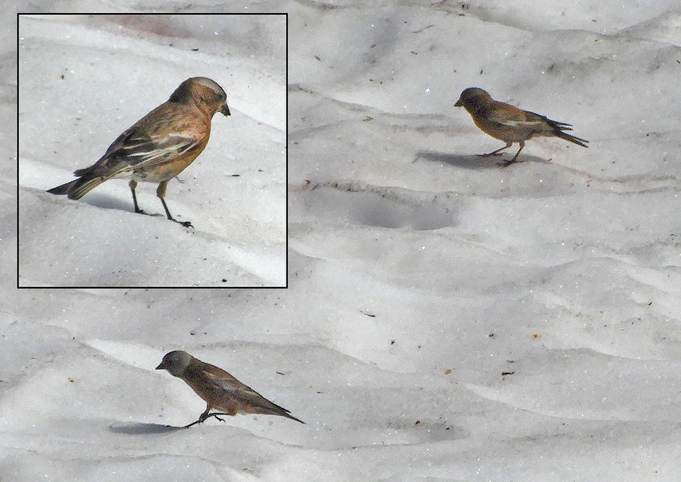
Another high-elevation specialty. These Grey-crowned Rosy-finches regularly forage for insects and seeds on the melting snow patches.
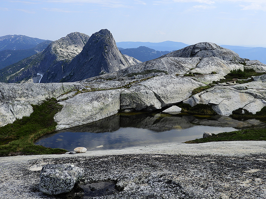
Finally – at the summit of Alpaca Peak with its lovely pond. There are actually two summits of equal elevation (2074 m according to my GPS). I’m standing on the west summit and the east summit is behind the pond, with Vicuna and Guanaco peaks beyond.
Looking east from Alpaca Peak – Vicuna and Guanaco peaks.
A wide-angle view towards Vicuna and Guanaco peaks.
Looking north-northwest from Alpaca Peak with Bighorn Peak in the middle-distance.
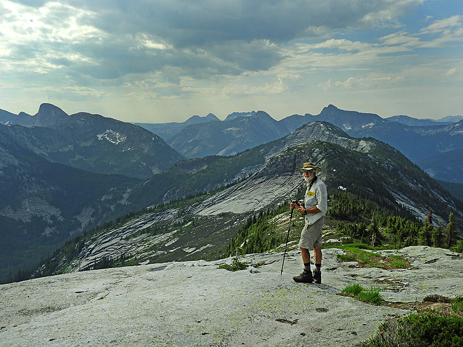
Chris looking north from Alpaca peak. In the far horizon one can see Stoyoma Mountain – the northernmost peak in the Cascade Range – another mountain that Chris and I have climbed.
Looking back south from Alpaca Peak at the route we took from Zupjok Peak and passing nearby llama Peak. Needle Peak and Flatiron Mountain in the middle distance.
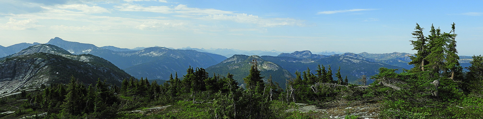
A panoramic view from near Alpaca summit with the Anderson Range on the left and Bighorn Peak on the right.
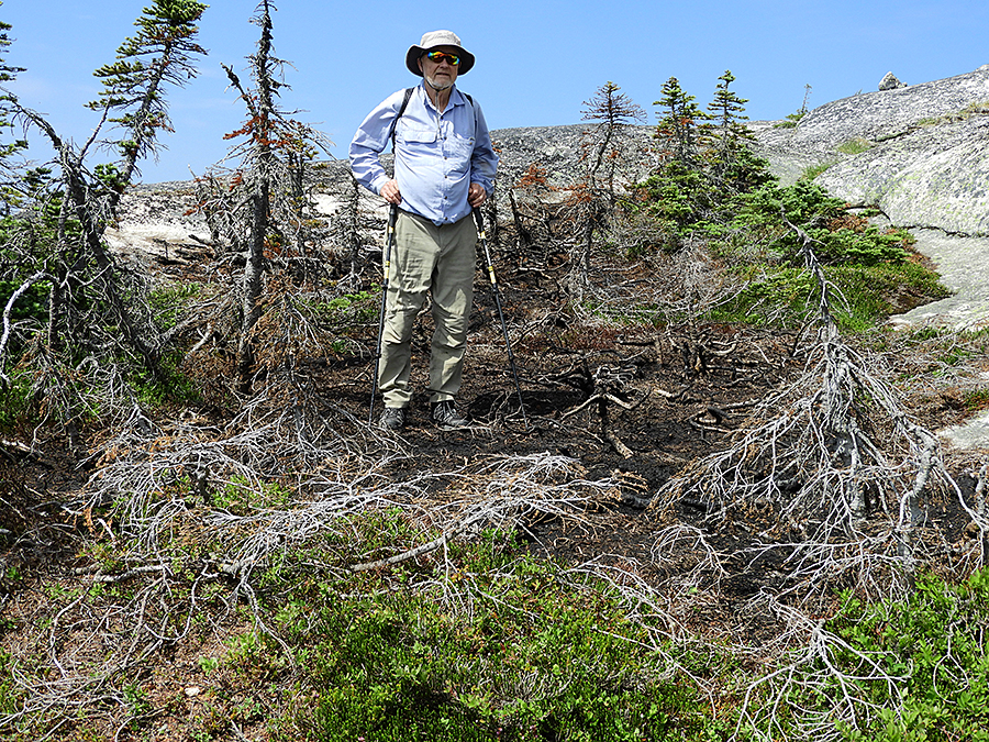
Near the summit of Alpaca Peak we found this burnt patch of stunted alpine trees – evidently a lightning strike last year.
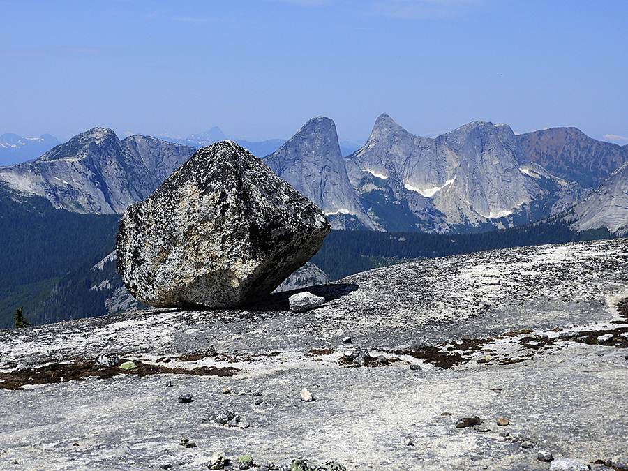
Another of these enigmatic ridge-top erratics – huge boulders dropped by glaciers in the most unexpected places.
Heading back from Alpaca Peak – a long hike along the undulating ridge to Zupjok Peak and then the steep descent back into the forest and eventually our car-park.
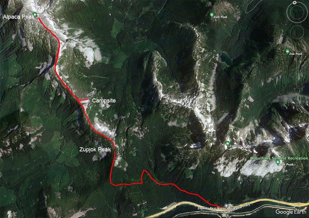
GPS track of our route – 7 & 8 July 2023.
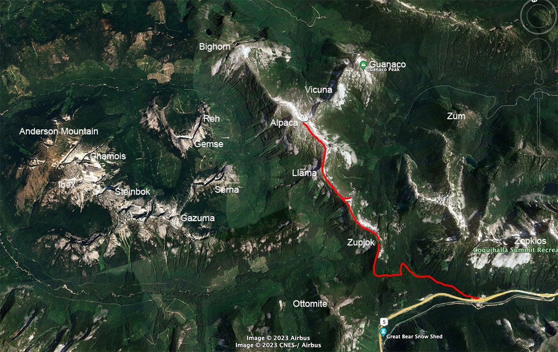
A wider view of our route showing the local peaks.
~~~~~~~~~~~~~~~~~~~~~~~~~~~~~